|
Day |
Data Availability |
General Characteristics |
Suitable for What? |
Whose Paper? |
|
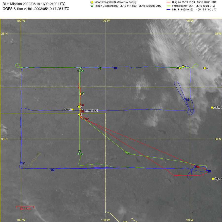
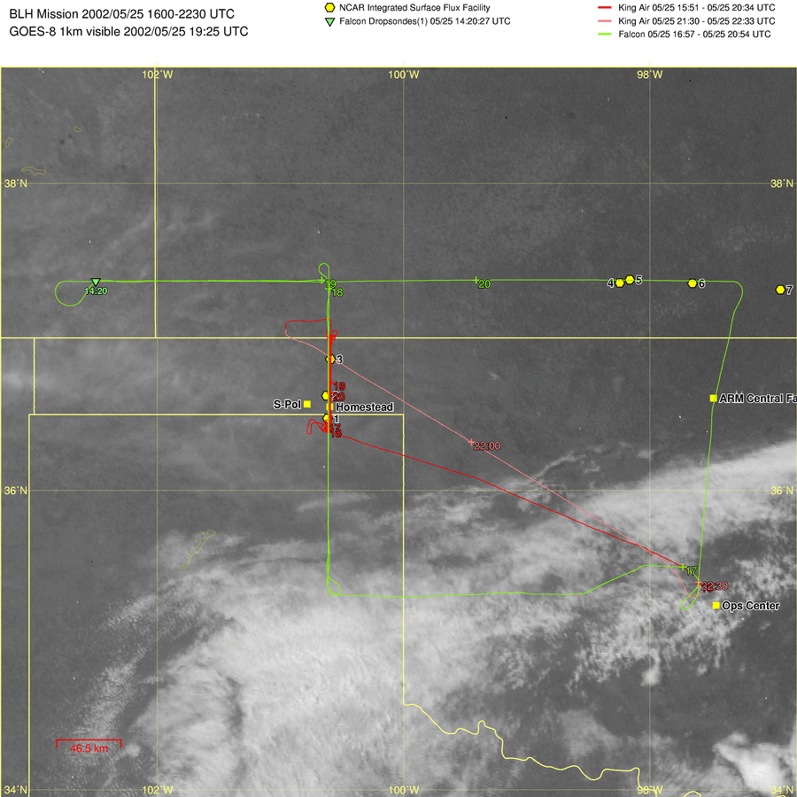
5/19 |
WYKA (WCR, 1550-2008UTC) DLR Falcon (1604-1923UTC) NRL P-3 (1541-2100UTC) MIPS |
-BLH (Western Track) -The
surface over the panhandle region is very dry. -A
relatively deep and active ABL with rolls and gravity waves in a well capped
ABL - A very dry stable layer just above the ABL |
BLH Inter-comparison |
|
|
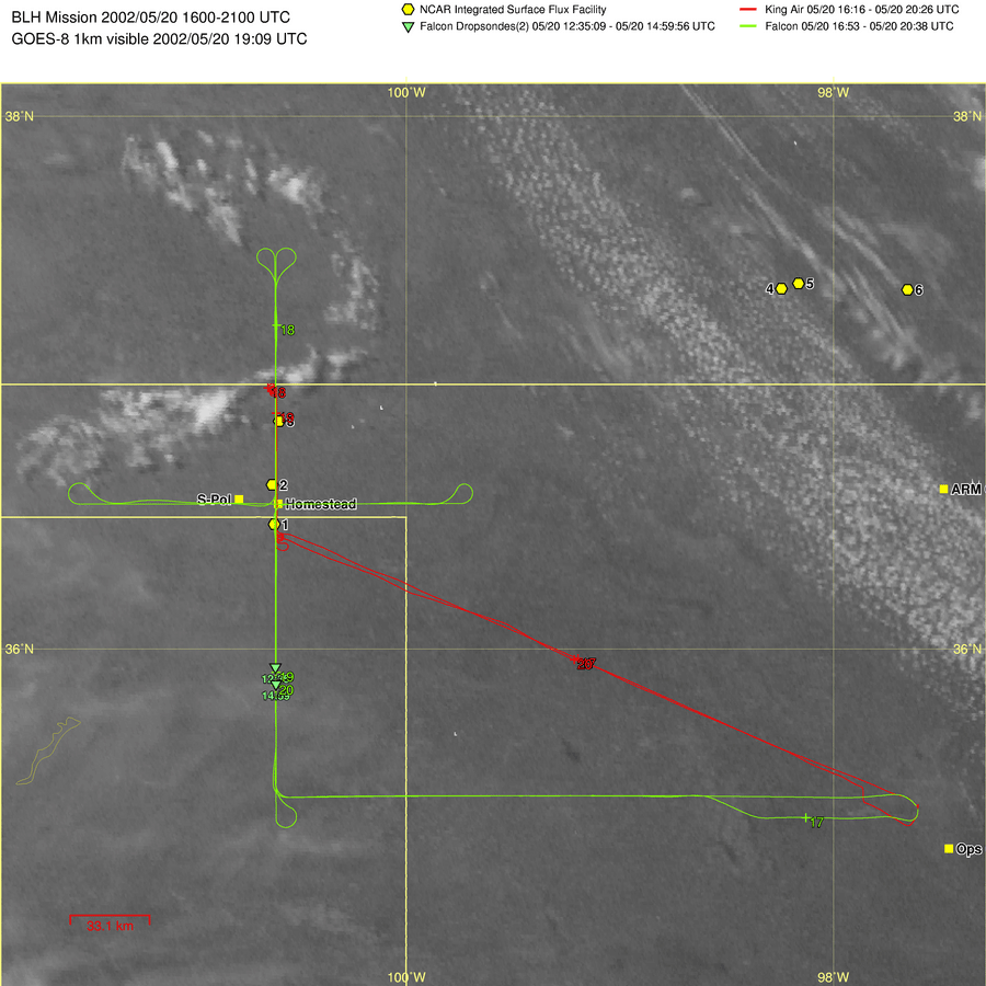
5/20 |
WYKA (1616-2025UTC) DLR Falcon (1653-2038UTC) DOWs, MIPS |
-BLH
(Western
Track) -Hot,
sunny and bumpy weather condition |
BLH Inter-comparison |
|
|
5/21 |
WYKA (1832-2012UTC) DLR Falcon (1957-2318UTC) NRL P-3 (1758-2314UTC) |
-BLH - A ridge over the central
plains persisted - Winds were from the
south - Fair weather cumulus
over central and eastern Kansas - A modest E-W gradient in
dew point temperature |
BLH Inter-comparison |
|
|
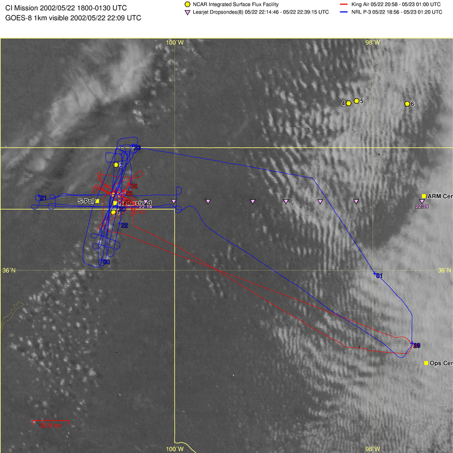
5/22 |
WYKA (Stack pattern
perpendicular to boundary, WCR 2058-0100UTC) NRL P-3 (Box pattern, 18:56-01:20UTC) DOWs, MIPS, DRI
|
-CI -Dryline between S-Pol and
Homestead. -No convective initiation,
but data obtained along boundary. |
CI Shallow Cu |
|
|
5/23 |
NRL P-3 (1607-1914UTC) DOWs, MIPS, DRI
|
-CI - Cold frontal boundary
near the eastern extreme of the Oklahoma panhandle. - Some loosely organized
convection drifting out of Texas -Middle level based
convection |
|
|
|
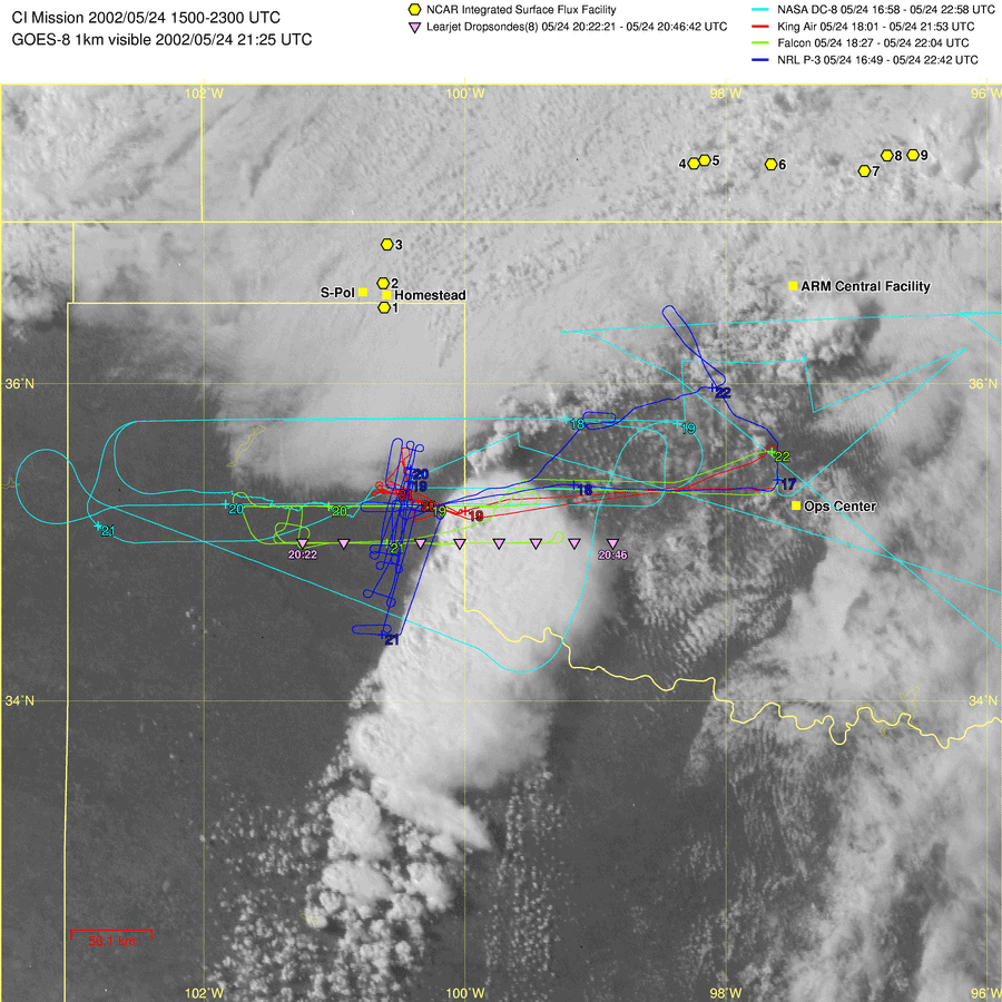
5/24 |
WYKA (Cross
dryline legs and cross cold front legs, 1801-2153UTC) NRL P-3 (box pattern, 1649-2242UTC) DLR Falcon (EW legs through
the dryline, 1827-2204UTC) NASA DC-8 (1658-2258UTC) DOWs,MIPS,DRI |
-CI -NS
dryline and quasi-EW cold front |
CI |
Richardson
|
|
5/27 |
WYKA (WCR 1508-1923UTC) NRL P-3 (mapping
moisture in southern KS, 16:01-21:54UTC DOWs, MIPS,
DRI |
-BLH &CI-East Track(BLH)-Spearman, TX(CI)- Occasional thin cirrostratus a few scattered altocumuli over southern
Kansas -Later
in the day, scattered cumulus at boundary layer top -Small east-west gradient in BL depth with higher heights in the west
|
BLH CI Inter-comparison |
|
|
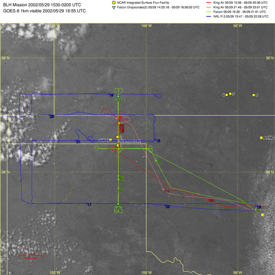
5/29 |
WYKA (Stack
mission, N-S west track over Homestead, WCR 15:36-20:29UTC, 21:46-23:01UTC) DLR
Falcon (Longer
N-S legs over King Air line 16:30-21:01UTC) NRL
P-3 (Moisture
mapping mission primarily E-W legs, 1547-2228UTC) DOWs |
-BLH -Homestead Area- Previous day a large amount of rainfall around Homestead -Clear skies in the western part of the
IHOP
domain with leftover cirrus and debris clouds to the east -Dry north and moist south-The boundary layer to the east of Homestead was moister (8-9 g/kg) and shallower (1.5 km) than west of Homestead(3-4 g/kg,2-3km) |
CI BLH Inter-comparison |
|
|
Day |
Data Availability |
General Characteristics |
Suitable for What? |
Whose Paper? |
|
6/2 |
WYKA (WCR Provisional 1947-2349UTC) NRL P-3 (HRDL
Provisional 1810-2340UTC) DOWs, DRI, MIPS |
-CI -A quasi east-west cold
front was located in northern Kansas with a dryline extending to the south. -The microburst activity |
CI |
|
|
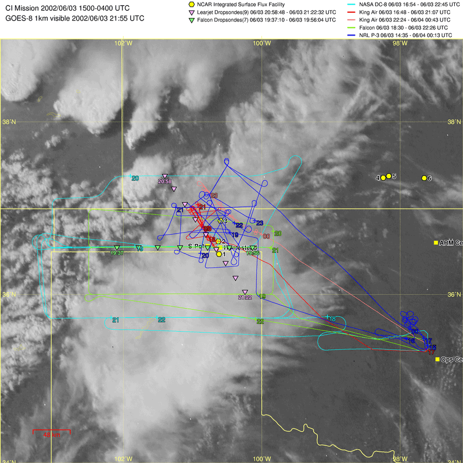
6/3 |
WYKA (Crossed front several times and conducted normal
stack,WCR 16:48-21:07UTC 22:24-00:43UTC), DLR Falcon (an E-W series of
three 200km legs, HRDL PROVISIONAL,
18:30-22:26UTC) NASA DC-8 (large scale moisture
field mapping, 1654-2245UTC), NRL P-3 (box patterns crossing
cold front, fine line, and dry tongue 14:35-00:13) DOWs, DRI, MIPS |
-CI Mission - A cold/stationary
front was in the OK
panhandle - The dryline never did form in the panhandle and convection was not initiated along the boundaries.- A deck of cirrostratus overhead, thickening towards the south. -The cirrus shield hindered the daytime heating and convective temperature was not reached. - A cap was maintained throughout the day with warm temperatures aloft |
CI Inter-comparison |
Markowski |
|
6/4 |
DOWs, DRI, MIPS |
-CI - Wheeler, TX -Severe storms in SW KS
with a great deal of midlevel clouds in the OK panhandle. - |
Inter-comparison |
|
|
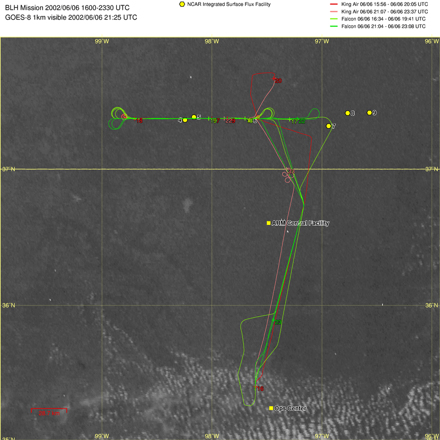
6/6 |
WYKA (WCR 16:08-19:58UTC 21:08-23:35UTC), DLR Falcon (an E-W series, 16:48-19:00UTC 21:28-22:51UTC) |
-BLH -
BL structure was heterogeneous, shallower on western end -
Skies were virtually clear, with a few small cumulus starting eastward -
There was some cirrus to the south - There was significant haze near the top of the BL |
BLH |
|
|
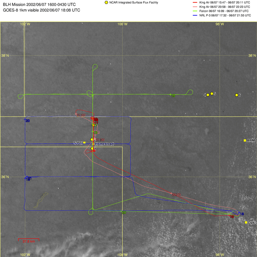
6/7 |
WYKA (WCR 16:03-20:10UTC 21:06-22:20UTC), DLR Falcon (Fluxes
& moisture mapping, HRDL 16:10-20:25) NRL P-3 (Moisture
mapping, 18:00-21:55) DOWs, MIPS, DRI |
-BLH -Homestead Area(Western Track) -BL
depth varied considerably -
Above 10 k ft, the mixing ratio was so low - The thermals seemed to be weaker in the middle of the track, and seemed to grow with time.
-Winds
were strong -Good data for both flux heterogeneity and budgets |
BLH |
|
|
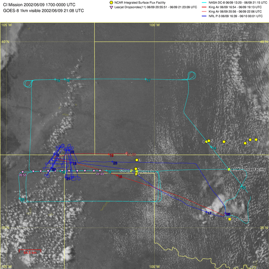
6/9 |
WYKA (WCR 17:00-19:09UTC), NASA DC-8 (Box over S-Pol from 98 to
104W, 1329-2115UTC), NRL P-3 (A series of
box patterns, 11:52-19:02UTC) DOWs, MIPS, DRI |
-CI -Well
defined dryline west of domain in am -No
convection along dryline in OK panhandle -An
ill-defined line of very shallow Cu, with more shallow Cu to the SW. |
CI Shallow Cu Inter-comparison |
|
|
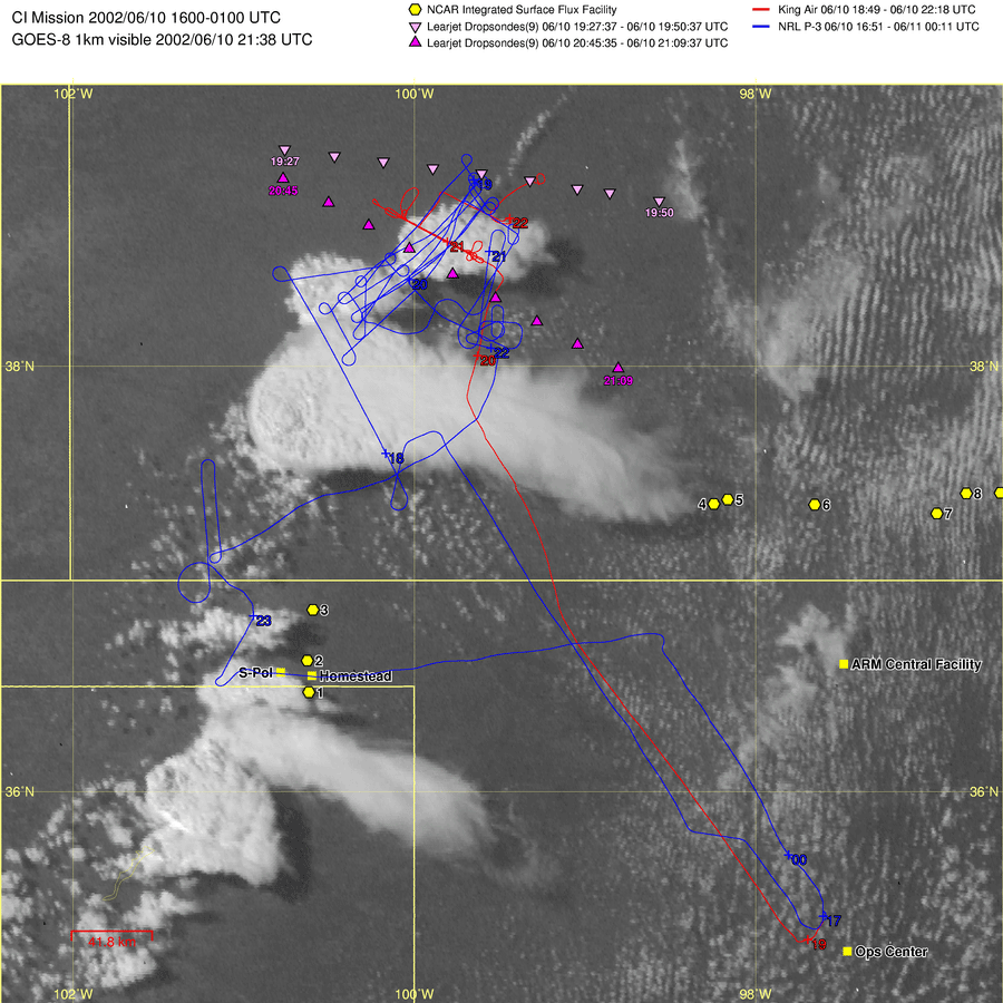
6/10 |
WYKA (a line-normal stack at various levels
between 160-1500 m AGL, 18:56-22:20) NRL P-3 (12:01-19:08UTC) DOWs, MIPS, DRI |
-CI -Weak quasi-stationary
cold frontal boundary sagging southward toward OK/KS border -Entire
boundary had growing CU and small CBs. -Cells
initiated along boundary |
CI Inter-comparison |
Richardson |
|
6/11 |
NASA DC-8 (E-W transects, 1640-2157UTC) NRL P-3 (Box-shaped
surveillance transects of boundary, 11:18-19:15UTC)
DOWs, MIPS, DRI |
-CI -Boundary
in Elmwood, OK area nearly stalled 15km SE of S-Pol. -Clouds
formed along the boundary but not deep convection. |
CI Shallow Cu |
|
|
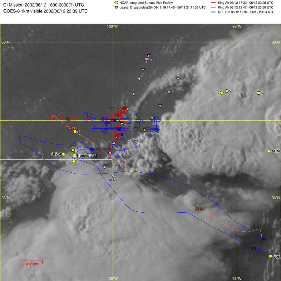
6/12 |
WYKA (a
normal stack across the boundary, WCR, 1732-2208UTC,
2247-2350UTC) NRL P-3 (east-west box along the
outflow boundary, 1634-2304UTC) DOWs, MIPS, DRI |
-CI -North of the boundary,
scattered thin stratocumulus; south of it, mostly clear; cloudiness
decreasing towards the west -Severe convection
initiated at the triple point. |
CI Inter-comparison |
Markowski |
|
6/14 |
WYKA(3500 and 4000 ft AGL, WCR 1019-1427UTC, 1457-1836UTC) DLR Falcon (1101-1516UTC, 1603-1821UTC) NRL P-3 (1043-1827UTC) NASA DC-8 (Larger
scale mapping, 1307-2126UTC) DOWs, MIPS, DRI |
-BLE -Mid and low-level clouds,
mostly stratocumulus, were present - The soil was wet with
plenty of standing water in the fields, except at the far eastern end of the
tracks. |
Shallow CU Inter-comparison |
|
|
6/15 |
WYKA (E-W legs, WCR,16:48-23:33UTC) DLR Falcon (1729-2100UTC) NRL P-3 (survey the region ,36N and 101.5W, 1648-2333UTC) DOWs, MIPS, DRI |
-CI -The
boundary was oriented N-S and was characterized as a broad area of confluence
in the wind field and some moisture variability -The
boundary increased intensity and focus as the time went on. -Cells
formed along the boundary in NW KS and propagated southward along it through
the afternoon. -There
was also convection moving in from the west. -The boundary did initiate convection at the intersection of it and the gust front form the large storm to the north. A few small cells did form directly on the boundary late in the day. - Thunderstorms did break out some 80 km further north along
the line, before 20:57 |
CI Inter-comparison |
Markowski Richardson |
|
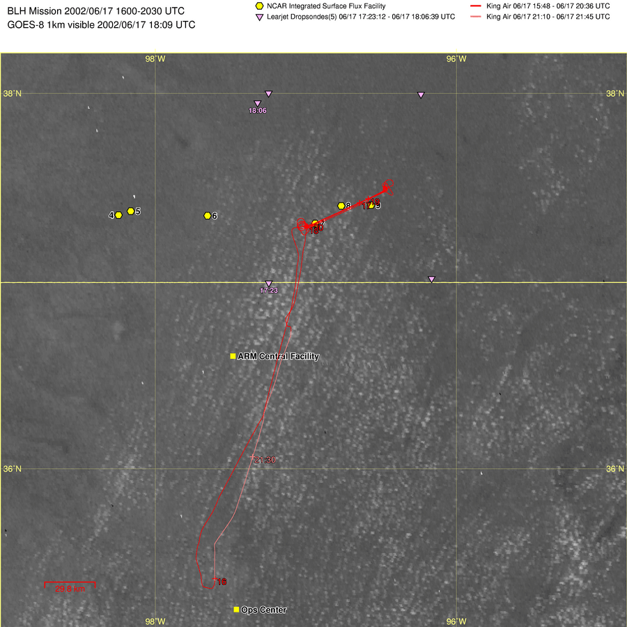
6/17 |
WYKA (WCR 1548-2036UTC, 2110-2145UTC) |
-BLH |
BLH |
|
|
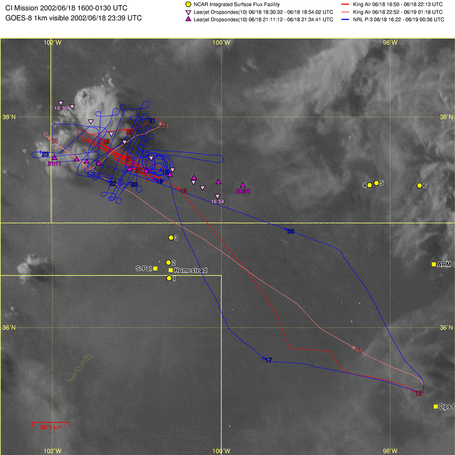
6/18 |
WYKA (ESE-WNW legs near 37:40N and 101:50W,WCR 1650-2213UTC, 2252-0118UTC) NRL P-3 (1622-0036UTC) DOWs, MIPS, DRI |
-CI - A combination of minor cold
front and dry line were believed to be present. |
CI Inter-comparison |
|
|
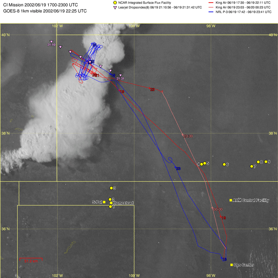
6/19 |
WYKA (sampled boundary using its standard pattern,WCR 1730-2211UTC, 2303-0023UTC) NRL P-3 (boxed
the boundary and captured evolution of convective initiation 1742-2341UTC) DOWs, MIPS, DRI |
-CI -Cold frontal boundary
(evident on radar) oriented NNE-SSW near
Goodland, KS moved toward
Colby, KS. -All instruments performed
well. |
CI Inter-comparison |
Richardson |
|
6/20 |
WYKA (WCR,15:52-20:13UTC, 21:38-22:14UTC) |
-BLH Mission -Deep convection area in
W. Kansas, S. Nebraska moving N-NE past the Eastern Track Area - Scattered cumulus,
scattered thin cirrus (thicker to NW in distance). -Seemed like the trade
winds! -Cu slightly thicker, moist,
slight static stability |
BLH Shallow Cu |
|
|
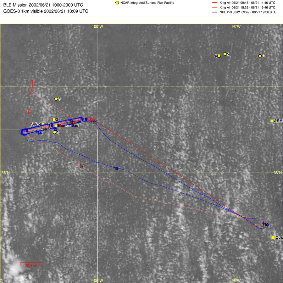
6/21 |
WYKA (Coordinating with the
P-3, Repeating 13 times the AB-BA circuit, WCR 10:00-14:54, 15:30-19:42UTC), NRL P-3
(a box pattern in a clockwise pattern, 10:27-19:30UTC) DOWs, MIPS, DRI |
-BLE Mission- Homestead Site- Some cirrus and mid-level clouds moving in from the SE -Wind speeds 15 kt at surface 20-25 kt at 850mb- High humidity(about 14g/kg) at all levels flown(3200-5400ft) |
Shallow Cu Inter-comparison |
|
|
6/22 |
WYKA (Eastern track, WCR 16:30-23:09), NRL P-3 (E-W Lines, 16:30-20:33) |
-BLH-Eastern Track-Clear conditions with some scattered Cu. |
BLH Shallow Cu |
|
|
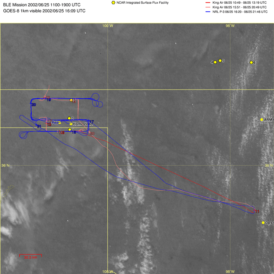
6/25 |
WYKA (WCR 1049-1319UTC, 1551-2049UTC) NRL P-3 (1620-2146UTC) DOWs, MIPS, DRI |
-BLE-Perryton, TX-Showers passing through early in the morning to the east of S-Pol and some cirrus clouds to the west |
Inter-comparison |
|